
Serving Michigan’s great Upper Peninsula and surrounding areas, we provide the following professional services
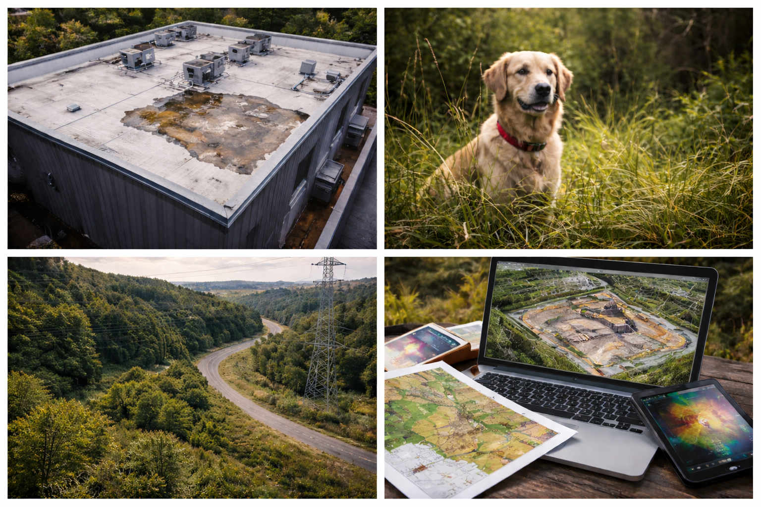
Mining and Construction: Volumetrics, Mapping, Modeling
Still using old methods of estimating?
Using labor intensive and expensive methods?
Need to fill the gaps between surveys and have faster results?
See if our solutions are a better fit for your project with NO RISK and ask about our pilot program. If our data isn’t useful, you don’t pay!
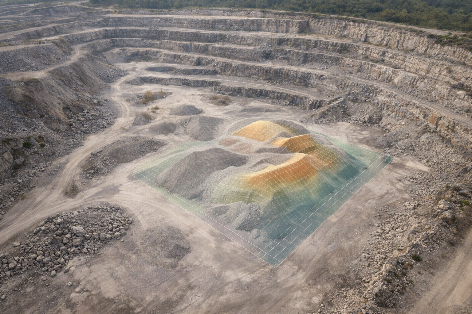
Volumetrics
RTK-enabled aerial volumetric measurements
Cut/ Fill analysis
Fast turnaround, typically 24-72hrs
Mapping/ Modeling:
High-Resolution 2D Ortho Maps
3d Mesh/ Modeling
Fast turnaround, typically 24-72hrs
Custom Exports:
Collect and export several custom options for your project:
.Tif (Ortho, DSM, DTM)
.Png/ Jpg
.Laz/.Las (Point Cloud)
.Csv/ .Txt (Point Cloud, Coordinates)
.Obj/ .Ply (3D Model/ Mesh)
.Dxf (Contours)
*We are not licensed surveyors and do not provide certified or legal measurements or boundaries. These measurements are not intended to replace licensed land surveying services.
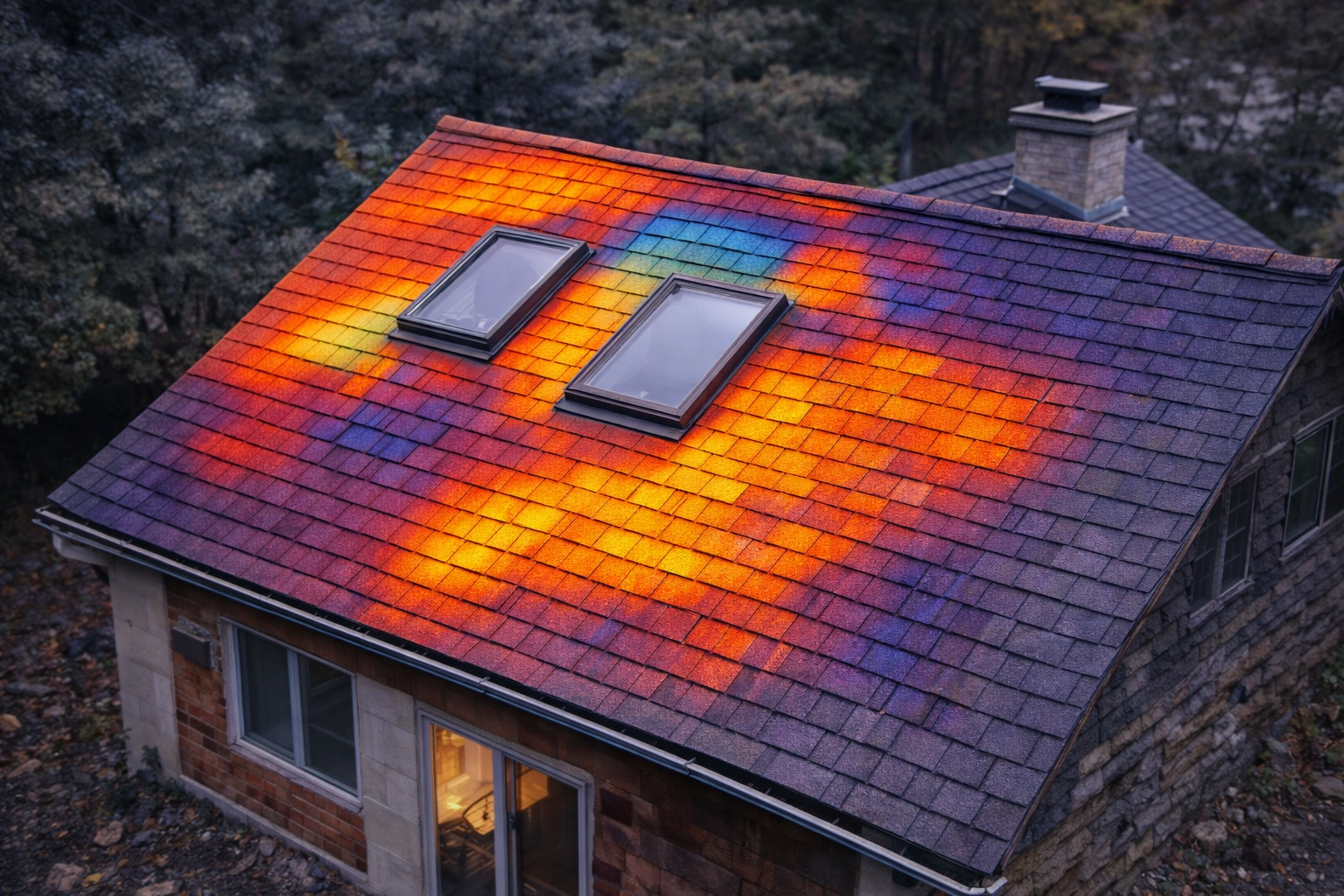
Roof and Property Inspections:
Independent roof documentation for the structures you don’t want to climb
Steep Pitch. Icy Metal. Aging Structures. Commercial Roofs. We capture high resolution aerial and thermal imagery safely from the air.
UP Aerial Solutions does not sell roofing or construction services. We provide third-party documentation so home owners, business owners, property managers and insurers get clear, unbiased data.
No Ladders. No Fall Risk. No Sales Agenda.
Residential Inspections
Observe and annotate damage to roofing material, vents, other components
RGB (Traditional) photos/ videos
Add thermal to check for heat loss, temperature anomalies, possible water build-up areas
Report with photos following the inspection within 24-48hrs (electronic delivery)
Gone for the winter and want a property check with current photos/ video? Give us a call!
Commercial Inspections
Quarterly, Annual, or ongoing assessments available
Assess steep/ unsafe to climb roofs from the ground
Observe/ annotate possible damage to roofing material, vents, components, etc
RGB photos/ videos
Add on 2D orthomosaic photo map of your commercial roof or ask about 3D modeling
Add thermal to check for heat loss, temperature anomalies, possible water build-up areas
Report with photos, videos and/or map following the inspection within 24-72hrs (electronic delivery)
Insurance Carriers
Pre-Loss Documentation
Post-Incident Evaluation
Note: While professionally trained to InterNACHI standards, we are not licensed building inspectors but we can safely work with you, your business, or your inspector to gather high-quality data to aid in evaluation and planning for your home or business.
Also, thermal images and findings are indicative, not diagnostic. Observed thermal patterns do not alone confirm presence of moisture, leaks, or defects and should be evaluated in conjunction with visual inspection and other information. Additional evaluation may be recommended to confirm conditions.
Forestry, Farming, and Land Management
Acreage mapping
Aerial imagery with 2D orthomosaic mapping available
Property Assessment
Assess roads and property access
Storm damage
Assess damages to your property for personal or insurance purposes

Pet Recovery/ Search and Rescue Assistance
Lost pet? Missing person?
We are happy to help!
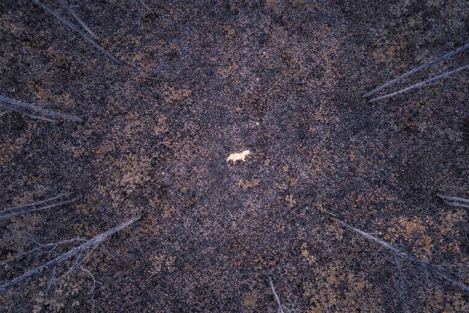
For assistance with missing persons, law enforcement should be contacted first! We are happy to help if requested but prefer the request come from law enforcement so we know they are aware of the situation and actually want our assistance. Many agencies have their own drone equipment however, sometimes having more than one drone is appropriate depending on the situation/ ground to cover.
The owner of UPAS LLC has several years experience working in the realm of public safety and can work with requesting agencies seamlessly.
Services
Filters
No results found
No results match your search. Try removing a few filters.
Contact us
Interested in working together? Fill out some info and we will be in touch shortly. We can’t wait to hear from you!